Pada bulan September 2021, dua tim pengabdian Prodi Ilmu Kelautan UB yang diketuai peneliti CORECT FPIK UB, Rarasrum Dyah Kasitowati, S.Kel., M.Si., M.Sc dan Ade Yamindago, Ph.D., melakukan kegiatan di Pantai Bajulmati, Kabupaten Malang. Terdapat dua topik yang menjadi pembahasan mereka, yaitu edukasi pengelolaan sampah plastik dan edukasi penggunaan alat monitoring kualitas perairan.
Sampah plastik yang masih banyak berserakan di area wisata Pantai Bajulmati, Kabupaten Malang yang dihasilkan oleh pengunjung maupun masyarakat disayangkan oleh dosen ilmu kelautan UB Rarasrum Dyah Kasitowati, S.Kel., M.Si., M.Sc. Untuk itu bersama tim pengabdian masyarakat prodi Ilmu Kelautan UB dirinya melakukan edukasi tentang bahaya sampah plastik pada perairan dan biota laut. Tim pengabdian masyarakat ini menggandeng Sekolah Alam Bajulmati dan Bajulmati Sea Turtle Consevation (BSTC) untuk melakukan edukasi kepada anak-anak sekitar pantai. Edukasi ini diharapkan dapat membantu membangun kesadaran pentingnya semua pihak menjaga kebersihan pantai Bajulmati dari sampah plastik.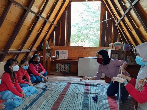
Edukasi bahaya sampah plastik oleh Rarasrum (kedua dari kanan) kepada anak sekitar pantai Bajulmati (kanal24)
Pada saat yang sama, pemeliharaan penyu di Bajulmati Sea Turtle Conservation (BSTC) pantai Bajulmati Kabupaten Malang masih dilakukan dengan sarana dan peralatan yang kurang memadai. Hal tersebut membuat Ade Yamindago, Ph.D. dan tim membantu masyarakat sekitar Pantai Bajulmati dengan mengadakan pelatihan monitoring kualitas air pada kolam pemeliharaan penyu dengan harapan untuk meningkatkan kemampuan masyarakatnya dalam melakukan konservasi penyu
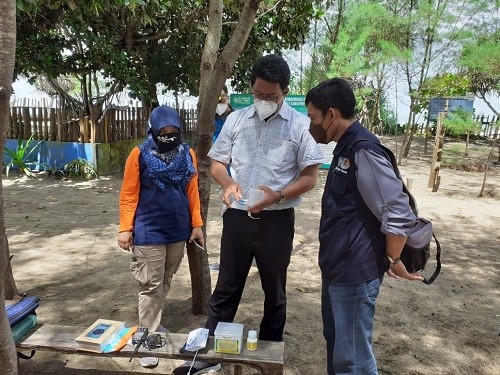
Ade (tengah) menjelaskan beberapa alat monitoring air kepada mitra BSTC (kanal24)
Selain edukasi mengenai ilmu monitoring kualitas air, Ade Yamindago, Ph.D. dan tim juga menghibahkan alat monitoring kualitas air untuk mendukung sarana dan prasarana bagi BSTC.
Pengabdian masyarakat ini disambut positif oleh koordinator BSTC, Sutari. Dari kanal24.co.id, Sutari menyambut baik dengan adanya pengabdian masyarakat dari FPIK UB ini kepada masyarakat sekitar Pantai Bajulmati.
Sumber: kanal24.co.id