Unmanned Aerial Systems (UAS) as tools for environmental monitoring increasingly becoming the main choice of users: both practitioners and academics, as well as other stakeholders. In coastal monitoring activities, low-cost UAV provide details and cost effective that are not well fulfilled by medium resolution satellite imagery, nor field survey activities. For this reason, the introduction of UAV and its applications become important skill for both academics and professionals.
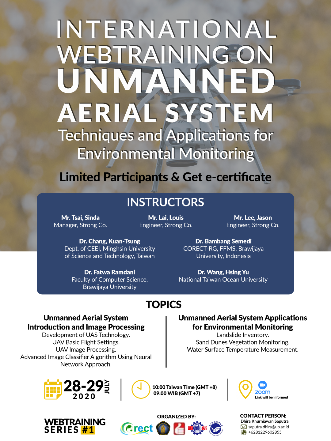
Continuing the training collaboration that was held in the previous year, in 2020, CORECT – MUST Taiwan and Strong Co.Ltd, Taipei again hold basic UAV training entitled “Advanced Tools for Coastal and Marine Monitoring”. Several national and international institutions were taking part in this activity, includes Lab. Geoinformatics, FCS UB, Agency of Marine Affair and Fisheries, Papua State University, Muhammadiyah Mataram University, Dept. of Harbor & River Engineering, National Taiwan Ocean University (NTOU) and Li-Jou Eng. Consultant Co.
This web training aimed to introduce the ability of UAS for mapping coastal shoreline as well as its environment. At least 70 participants were joined into this webtraining. They come from various academic background and knowledge related to remote sensing its application for coastal monitoring. Webtraining consist of two session (1) introduction of MUST and Strong institutions (2) Application of UAS for coastal monitoring: flight setup, data processing and image classification. Some of the topics presented in Session I include (1) “Development of UAS Techniques”, by Mr. Sinda Tsai (Manager, Strong Co.) and Mr. Louis Lai (Engineer, Strong Co), (2) “UAS Basic Operation: Introduction to UAV flight settings” and “UAS Basic Image Processing: create high quality orthophoto images, by Mr. Jason Lee, and Mr. Louis Lai (Engineer, Strong Co.). In Session II, Dr. Hsing-Yu Wang presented “Monitoring thermal plume and temperature distribution by using airborne infrared camera”, continued by Dr. Kuan-Tsung Chang with the topic of “UAV for environmental monitoring: Apply UAV Multi-Sensors Data for Landslide Inventory”. Last instructors who gave presentation at the event was Dr. Bambang Semedi and Dr. Fatwa Ramdani from Universitas Brawijaya, with the title of “Coastal Monitoring Using UAVs Data: A Case Study to Assess the Change of Vegetation in Parangtritis Sand Dune Area, Indonesia” and “Advanced Classifier Algorithm to Ultra-High Resolution Unmanned Aerial Aircraft Imagery – A Neural Network Approach”.